By Sharon Kiburi
Nairobi, Kenya: When the COVID-19 pandemic broke out, Kenya needed data and evidence-based solutions to form informed policy decisions. The technology sector in Kenya was ready, Esri, Women in GIS, WHO, Jomo Kenyatta University of Agriculture and Technology (JKUAT) & Palladium and health Kenya. Women in GIS Kenya (WiGISKe) in collaboration with the Ministry of Health (MOH) Kenya, developed tools using Geospatial data mapping to stay ahead of the curve on COVID-19 response, with a platform form provided by Esri.
Remmy Kesis is an independent scientist expert in Geographical Information Systems and Remote Sensing (GIS & RS). “I got into the field of location mapping after pursuing a project while in University that used Geospatial tools mapping areas of wetlands in Bungoma county in Kenya”, he explains GIS is data and information about a location, while RS refers to aerial photography for mapping, using satellites, airplanes, and drones.
Geospatial technology involves three main things: data, software tools, and people. In collecting data with a specialized tool such as Global Positioning Systems (GPS), all related applications and systems stored on a mobile device. The system provides information such as location, velocity, and time synchronization and can be available rapidly. He has worked with the tool in the Covid-19 application; he commends the Women GIS network for the user-friendly interface and their broad consultative process.
I met some of these incredible women experts leading the process in Kenya. They are breaking stereotypes, challenging norms, and creating solutions in all areas of work in Kenya. I also had the advantage of learning about what geospatial data mapping entails and how it can help Kenya find evidence-based solutions to their problems.
“We felt a calling as Women in GIS to contribute to the MOH public dashboard by creating an online COVID-19 Self-Test (Test) that asks a series of questions to individuals to determine whether they are experiencing COVID-19 symptoms. The tool collects location information, classifies risk level, and provides a list of nearby health facilities based on the spatial location for severe and high-risk cases‘ ‘ said Yariwo Kitiyo one of the founders at WiGISke.
Our expert, Remmy also noted that Geospatial data could track patterns and trends of the COVID-19 spread in the country. The dashboard at the Ministry of Health website mapping the locations to get more cases and models across the demographics. Besides, the collected data can serve as a point of reference in decision making. Geospatial technology can map information on Gender-based violence (GBV), poverty beyond the COVID-19 pandemic. “With the right partnerships, Geospatial data can provide long term evidence-based solutions to issues affecting society,” Therefore, they created a COVID 19 self-testing application by an all-woman team in GIS.
Cecelia Wanjiru is a twenty-year-old student in the school of law at the University of Nairobi in Kenya. She kindly shared her user experience of the application. She took the online COVID -19 testing. “I first heard about the test when a friend of mine sent me a link via WhatsApp. I was curious, so I took the questions, which were very simple to answer,” said Cecelia. She felt going through them; one can learn about some of the symptoms of COVID-19.

“The answers I gave were rated, and the response received was of low risk. The application collected my location by running a geographical location system. “I think this may play a huge role in marking the number of cases in an area.” Said Cecelia Wanjiru. Further, Cecelia said, she found the process fun, so she recommended it to her friends by sharing a link. Adding, “My only question of concern was how long it would take for one to get help if they tested high risk from the online questionnaire,” said Cecelia Wanjiru.
James Ngige 29, works in IT with the Kenya Revenue Authority (KRA) borderless tracking and licensing department. He received a link from a friend via WhatsApp. “I found it innovative, especially in the current circumstance, and the fact that the application is web-based which is great because one does not have to download it. I love the user interface; it is friendly and invoking interactions,” said James. In the future, MOH can use the app to track other real issues beyond COVID-19 so, long as individuals are sincere in how they answer the questions.
Many users and government officials spoke highly of the user interface and its friendly nature. It is most certainly due to the talent of the Women in GIS.
Three women founded women in GIS Kenya: Caroline Akoth, Sophia Njeri Murage, and Yariwo Kitiyo, to bridge the gender gap in tech by creating a community of visionary women in the Geospatial industry. Yariwo Kitiyo inspired the passion for GIS and the creation of the network. “It sprang from the immense capabilities of GIS tools.
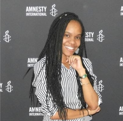
My first interaction with mapping and analytics was towards the end of my bachelors where I represented KU at a regional user conference and from then on, it has been fun unlocking one fascinating capability after another.” Sophia says “Everything started with the passion for space science and learning about constellations. It was during this pursuit that I landed in Geomatic Engineering at JKUAT and found this encompassing field of GIS that allows me to explore spatial information across all bounds.”
Esri provides the platforms to support the applications developed by Women in GIS. Onesmus Kamau Head, e-Health and Systems Development Unit at the Ministry of Health has welcomed the collaboration. He says In response to the COVID-19 Pandemic the department had partnerships with many organizations such as Women in GIS, WHO, Esri Eastern Africa, Jomo Kenyatta University of Agriculture and Technology (JKUAT) & Palladium, and health Kenya. “All these partnerships have aided in contact tracing and data management, says Onesmus Kamau.
“Women in GIS and JKUT were instrumental in creating the dashboard”, said Onesmus Kamau. The dashboard visualizations of the spread of COVID-19 all over the country. The dashboard has incorporated global reported data to inform the public. The MOH has been able to integrate the dashboard with the disease modeling to inform policymaking. “The online assessment test created by women in GIS has been fundamental in locating areas with increased cases and predicting high-risk zones in response preparedness,” Said Onesmus Kamau.
Onesmus Kamau says the partnership with Women in GIS Kenya and JKUAT has also been worked with the ministry of health in the Universal Health Care in Kenya. They created a dashboard for mapping indicators of Universal Health care among the diverse demographic needs.
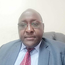
Esri East Africa, through a memorandum of understanding, has provided its Geographical Information Systems (GIS) tools to be used in the dashboard for Geographical locations mapping. “The opportunity this technology is creating enables devolution growth in different counties, by providing mitigating factors on how to allocate resources in response to COVID-19,” Said Onesmus Kamau.
To understand how the Esri Platform works, I tracked down Gerald Yegon who is the Industry Manager Natural Resources and lead at Esri’s East Africa support to the government He says “Esri provides tools, technology, data and services for mapping. It does this through the ArcGIS platform, which is a combination of desktop, mobile, and online mapping tools that help in decision making.”
Esri East Africa is helping the ministry of health (MOH) Kenya in also responding to Covid-19 cases. Through the Esri emergency response and disaster relief support program mobilized to offer a COVID-19 response support package to countries and agencies involved in COVID-19 response. Gerald Yegon says the tools provided by Esri enable the Kenyan government to achieve the following.
One, Mapping Cases- through real-time data collection and use of dashboards, Monitoring disease spread (locations of cases including travel history), Identifying vulnerable populations and places (Using data such as poverty, communities with high prevailing health conditions such as HIV, diabetes), Assess Capacity- Of National and county governments, ie. Mapping Quarantine facilities location, bed capacity, workforce capacity, testing centers. Also, maintain Situational awareness and communication, e.g. through dashboards, and using location modeling to help identify high-risk areas and a partnership to deploy the response package which now also includes modeling data and mobile apps.
“The data collected in the Esri platform being used to Inform the public, Scientists are using it for modeling and identifying high-risk areas and universities are using it for research. This data can also ease the contact tracing process” elaborates Gerald Yegon.
Esri not only supports women networks but also introduced us to a woman GIS expert internally, Pauline Okeyo, Solution Engineer at Esri. “Geospatial data is an integral component in addressing COVID -19 as it provides vital insights necessary for visualizing hotspots and monitoring the spread of cases,” said Pauline Okeyo.
As a result, it helps the government and its stakeholders to plan better its response efforts based on the distribution of resources required for this.
“Location information is critical to the decision-making process associated with large disease outbreaks,” said Pauline Okeyo. For instance, GIS is critical in answering many infectious disease-related questions, such as: Where are current cases in the community, and where will the virus likely spread? Do we have schools in socially vulnerable areas? Which neighborhoods are distant from a testing site? Do we have communities or specific population demographics that are at higher risk? Which facilities and staff are in harm’s way? What does surveillance data on the number of hospitalizations and deaths suggest regarding the following? Distribution of hospital supplies and hospital beds on a regional or county basis? How quickly local and regional hospital resources get depleted questions Pauline Okeyo.
Women in GIS Network say that data analysis and visualization has made it possible to highlight gender gaps in health services, provision, in the corporate space, in the justice system, among other sectors. The visualization of data highlights glaring weaknesses that we could otherwise ignore in a written report or qualitative analysis. Having women’s voices involved from the start in the development of software applications and data collection tools means that the concerns specific to women appropriately included addressed.
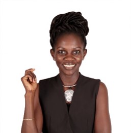
Yariwo narrates how the women in the GIS network came together. “The story of how it all began is quite surreal. WiGIS Kenya was formed on a cold night along the riverside drive, right next to the Chiromo overpass. She laughs, “I remember it was cold because I was low-key freezing”. Caroline, Njeri, and I were just returning, from hosting an event at Metta themed ‘Monetizing Geospatial’ that sparked a conversation amongst ourselves around building an all-inclusive vibrant, cohesive community of spatial data scientists. We wanted to have a similar event that was women-focused, we thought of why not have a women-focused inclusive community that celebrates the strides of women and uses GIS skills in the empowerment of women’s agenda across various sectors”.
Sophia expresses, in her opinion, there are not many women in the digital space or stem courses at the school level because “Societal norms and upbringing have led many to believe that their male counterparts can only do science and technology. Many male-headed families still practice this norm consciously and subconsciously, for example, buying engineering toys such as cars and building blocks for boys and dolls and cooking toys for girls. I am not saying this is wrong; however, it triggers a shift in the mind-sets of many children of our ‘roles’ in society.”
Women in GIS offer the following advice to aspiring young ladies willing to get into the field of science: “Filter out all the unnecessary background noise. We are in a society that is driven by pre-existing norms and culture of what a girl can and cannot do. It is up to us to redefine that; it is up to us to slowly change that narrative”. “If you have a passion or talent, explore it to its fullest and use your skills in every way possible. Set your standards in life and don’t let society dictate it,” Said Sophia. While Caroline said “Occupy space. Talk about your work and skills at every opportune moment”.
For now, what is obvious, is that Kenya was able to rise to the data challenges posed by the COVID-19 pandemic by working collaboratively, in an inclusive manner and ensuring that women and men, international and national organizations, and different ministries worked together to find solutions for a common problem.
A version of the story was first published at Zenger news.

