
|
Getting your Trinity Audio player ready...
|
By Gabs Mia
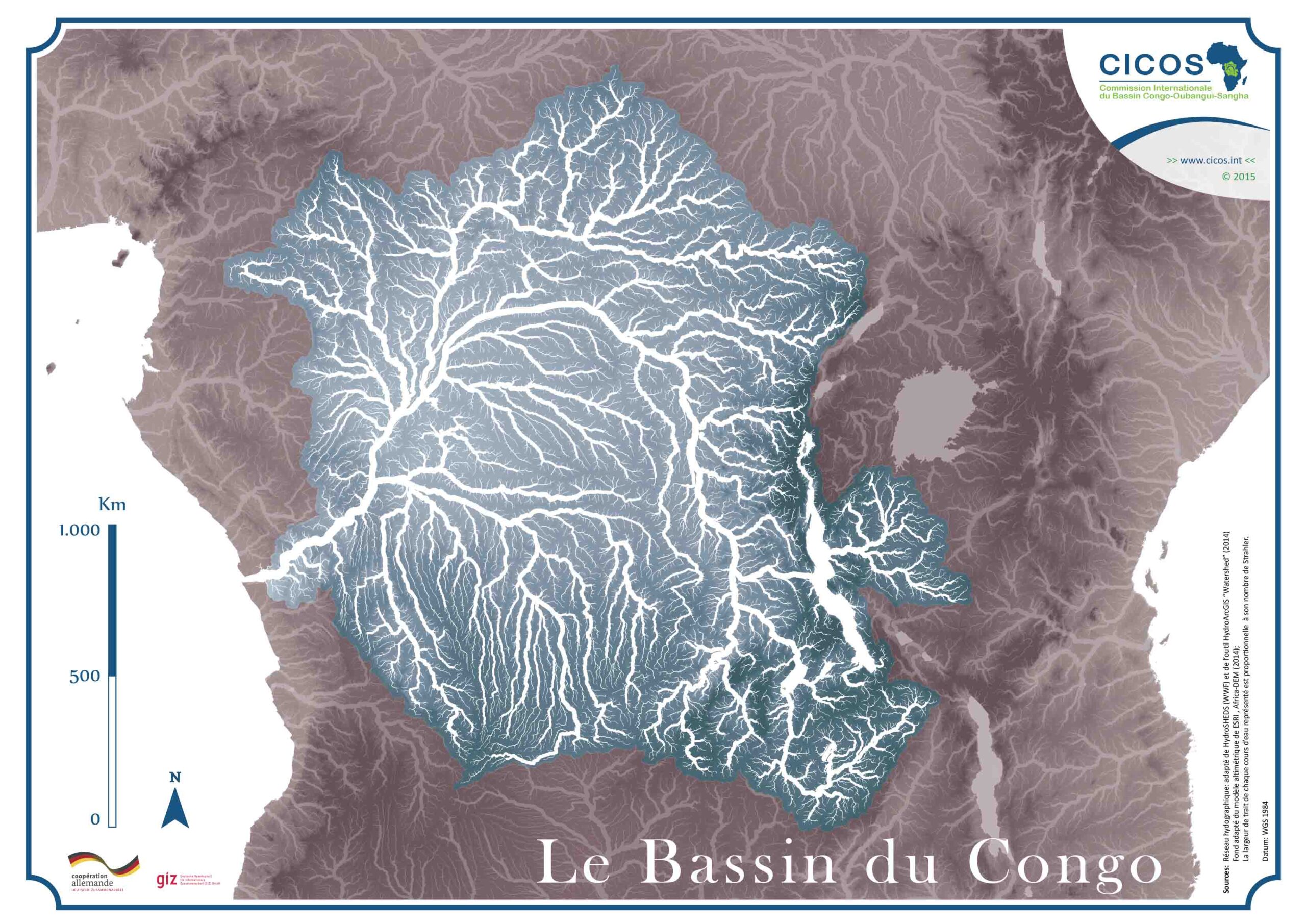
Kinshasa, DRCongo: A groundbreaking revelation has unveiled the astonishing volume of drainable water nestled within the immense Congo River basin. Recent findings indicate that this basin encompasses a vast water stock, estimated to be approximately 480 km3, which amounts to a quarter of the Amazon basin’s water reservoir.
Remarkably, it takes nearly five months for this colossal water reserve to completely drain. Until now, the hydrology of the Congo River has remained largely uncharted and enigmatic. However, these newfound estimates mark a significant milestone in unraveling the critical scientific enigmas of our time.
This awe-inspiring river system, renowned for its extraordinary size, not only serves as a haven for a tropical forest but also hosts an enormous peat bog. Its pivotal role in fostering biodiversity and influencing global water and carbon cycles cannot be overstated.
The amount of soil water that can be easily removed is a key factor in understanding the hydroclimatic processes around this major river system and in better managing the region’s water resources in the context of climate change.
“This information is essential for understanding the hydro-climatology of the Amazon’s African twin, modelling how it works and predicting fluctuations and their impact on the environment and human activities,” explains Fabrice Papa, an IRD hydrologist specializing in remote sensing from space at the Laboratory for Space Geophysical and Oceanographic Studies (LEGOS).
The scientists’ ingenuity and cutting-edge space techniques were essential for these results. These scientists from the University of Stuttgart (US) in Germany and the Congo Basin Water Resources Research Centre at the University of Kinshasa in Democratic Republic of Congo have successfully overcome the geographical and historical obstacles to observation in this region.
The Congo River Basin is difficult to access due to a lack of communication routes and political stability, and there is a serious lack of in situ observation. “Until the 1960s, there were several hundred hydrological measurement stations, but only around twenty are operational today, which is totally inadequate for the world’s second-largest river basin”, points out Fabrice.
Earth Observations Satellites (EOS)
To make up for the lack of ground-based instruments, scientists resulted to satellite altimetry data to estimate water levels and flow at measuring points in the basin, which are known as virtual stations.
Scientists used satellites from NASA and the German space agency to measure local changes in Earth’s gravity. This allowed them to assess the temporal and spatial variations in the total quantity of water present at a given time over the entire basin.
By relating variations in water stock to the river’s flow rate, they were able to determine for the first time the stock of drainable water, which is all the freshwater on the surface, in the soil, and in the aquifers that can contribute to the river’s flow rate.
Climate change is already having a negative impact on the Congo Basin, according to experts. This is evidenced by deadly floods, such as the one that occurred in Eastern DRC, as well as hydrological droughts and society’s need for accurate forecasting.
Additionally, the World Bank estimates that approximately 575,000 Congolese live in forested areas and rely on this fragile ecosystem for their livelihoods, making biodiversity conservation a major challenge.


